

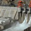
The proposed Siang Upper Multipurpose Project, with a capacity of 11,200 megawatts, is among India's largest hydropower projects. Its objective extends beyond electricity generation to include the development of water storage capacity that could help India respond to the potential effects of China's upstream dam. The project is intended to serve as a possible safeguard by helping regulate sudden increases in river water when required.
China approved its approximately 60,000-megawatt hydropower project on the lower reaches of the Yarlung Tsangpo River in Tibet in December 2024. The river flows through deep gorges in the eastern Himalayas before entering India, where it is known as the Siang and later the Brahmaputra. Its steep descent through mountainous terrain creates conditions favourable for hydropower projects, with water flowing at high speed through the region.
For India, the central concern is not limited to China's electricity generation plans. Since the project is located upstream, China could gain the ability to influence the river's flow through decisions involving dam operations, water storage and releases. India is concerned that sudden releases of large volumes of water, or damage to the dam during an emergency, could have devastating consequences for downstream areas. These risks have led to concerns that the Chinese project could potentially be used as a water weapon against India.
Rather than relying solely on assurances from China, India wants to develop its own protective mechanism through the proposed Siang project. If the reservoir has sufficient storage capacity, it could help regulate sudden inflows and manage water levels when necessary. The project also carries strategic significance because the two countries could face greater tensions in the future over river flows and access to information about water management.
However, the proposal has encountered substantial resistance in the Siang Valley, where the Adi tribal community views the river, land and forests as integral to its culture, social organisation and ancestral heritage. Residents fear that the dam and the reservoir it creates could submerge a substantial portion of their villages, paddy fields, orchards and land used for traditional farming. They are concerned that a project intended to address a national security challenge could threaten their homes, livelihoods and cultural identity.
According to a report by The Indian Express, 27 villages could be submerged by the project, potentially displacing around 1.5 lakh local residents. The Adi community relies primarily on agriculture, horticulture and natural resources. Paddy cultivation, shifting cultivation and traditional horticultural practices are important parts of local livelihoods. The construction of the dam could therefore affect household incomes, social relationships and community life across the region.
The Siang River also holds a significant place in the religious and cultural beliefs of the Adi people. Their traditions are closely associated with the ancestral figure Abo Tani and beliefs that regard the river as a mother. For the community, the river cannot be viewed merely as a resource for generating electricity or supplying water. It is closely connected to their identity, inherited traditions and collective memory.
As reported by The Indian Express, traditional councils known as Kebang have historically served as forums for discussing village-level social and community matters. In August 2025, a major traditional gathering of the Adi community was held in Geku, where participants opposed the proposed dam and the preliminary investigations associated with it. Local organisations have argued that it would be inappropriate to advance the project without giving adequate consideration to the concerns of affected communities and obtaining their consent.
For India, the Siang Upper Multipurpose Project has significance on three levels: electricity generation, water management and strategic competition with China. With an installed capacity of 11,200 megawatts, the project could make a substantial contribution to the country's electricity generation once completed. Its proposed storage capacity could also help regulate river water according to requirements, while providing a potential means of responding to changes in upstream water flows.
The strategic dimension has become particularly important because China's project is being developed in the upper reaches of the river near India's border. The possibility of future disagreements over river flows, reservoir operations and the sharing of hydrological information adds to India's concerns.
India and China established an arrangement in 2002 to share information about river water levels during the flood season. With a project of this scale on the upper reaches of the river, information about water flows, reservoir operations and emergency situations could become even more important for downstream safety and coordination between the two countries.
The debate surrounding the proposed Indian dam raises a broader question: can the concerns of local communities be pushed aside in the name of national security? Environmental and river experts have suggested that India should also pursue an independent assessment of the potential effects of China's project, improved information-sharing arrangements and options such as a joint impact assessment. They argue that simply building a larger dam in response may not be sufficient to address the full range of risks.
As India weighs its hydropower ambitions against the strategic implications of China's upstream project, the future of the Siang Upper Multipurpose Project will depend not only on its potential role in electricity generation and water management, but also on how the concerns of the Adi community, the risks to downstream areas and the need for reliable information about river flows are addressed.
About The Author









Comment List